Designated Properties
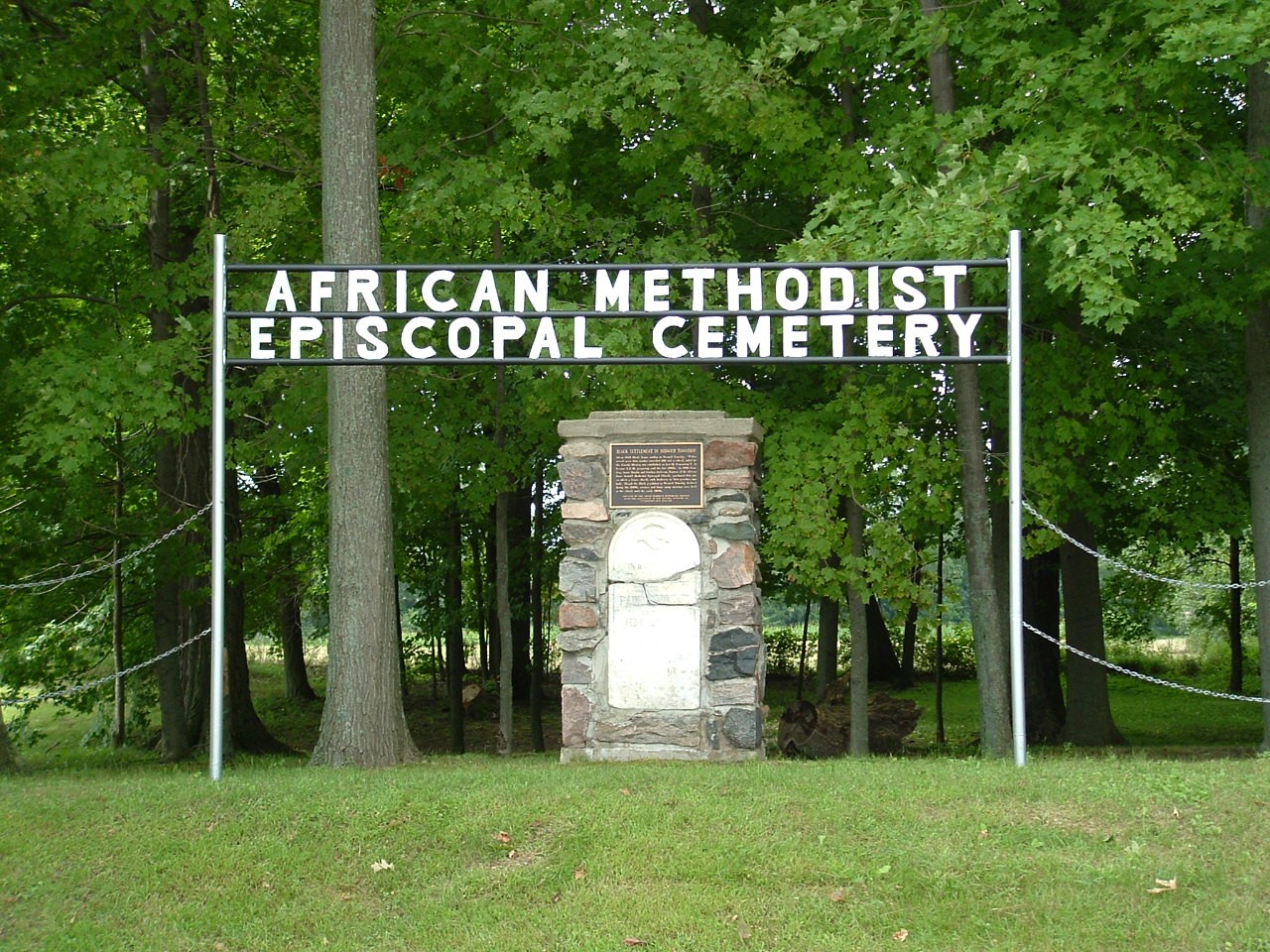
Description of Historic Place:
The African Methodist Episcopal Cemetery is situated on the west side of Church Street, km north of County Road 19, at the edge of the Village of Otterville, in the Township of Norwich. The property is the location of the former African Methodist Episcopal Church and the burial ground of the area's first black settlers.
The property was designated by the Township of Norwich, in 2006, for its historic or architectural value or interest, under Part IV of the Ontario Heritage Act.
Heritage Value:
The African Methodist Episcopal Cemetery, the burial place for over 140 Black pioneers, is one of the few remaining black pioneer burial grounds in Ontario. It is also significant as the site of the former African Methodist Episcopal Church. Established by Isaac Grey, Isaac Durphy and Lindsey Anderson, who were trustees of the African Methodist Episcopal Church, the frame church, with Anderson as its first preacher, served the Black pioneer community from 1856 until the late 1880s. Free Blacks and escaped slaves fled persecution in the United States and sought refuge in Canada. On the encouragement of the local Quaker population, Blacks came to the Norwich area beginning in 1829. The local Black pioneer population grew to almost 100 by the year 1860.
Though the Black population in the Norwich area thrived for many decades, by the early 1900s the community was in decline, as most of its members had moved to live elsewhere, many resettling in the United States. Over the course of time, the church fell into disrepair and was demolished. The cemetery site became degraded and most of the stones which marked the burials were removed. Nature has taken its course and the site is now a forested landscape. More recently, however, the Township of Norwich and the local community has undertaken a restoration of the Cemetery site that includes small marble
markers with candle engravings that denote the burial places of the 144 Black pioneers. Cornerstones were placed to mark the location of the original frame Church. These efforts demonstrate Otterville's pride and appreciation for a truly significant era in its history. Sources: Township of Norwich, By-law 63-2006; Pettigrew, Joyce, Safe Haven: the Story of the Black settlers of Oxford County.
Location:
PT LOT 12, CONCESSION 8, PART 1, PLAN 41R1604 CHURCH ST, OTTERVILLE (SOUTH NORWICH) HISTORICAL DESIGNATION BY-LAW 63-2006
The Curries United Church is located at 465003 Curries Road, and is situated on the northeast corner of the intersection of Curries Road and County Road 59, in the Village of Curries, Township of Norwich. The
one-and-a-half-storey red-brick church was constructed in 1891.
The property was designated, by the Township of Norwich, in 1984, for its architectural and historic value or interest, under Part IV of the Ontario Heritage Act (By-law 14-84 amended by By-law 67-2021).
Heritage Value:
Curries United Church is located at a well-travelled intersection between various cities and towns including Ingersoll, Woodstock, and Norwich. The church's orientation to the intersection acts as a historical focal point for the rural community as well a landmark to those travelling through the
area.
Curries United Church was constructed in 1891. A newly established Wesleyan Methodist congregation that would evolve into the United congregation purchased the land for the church in 1855. Several families have worshipped at the church for five and six generations, and include members of the 1891 congregation in their ancestry.
The Curries United Church is associated with the development of Curries community and Cuthbertson, the church's architect. Cuthbertson was a notable local architect, who based his practice in Woodstock.
Curries United Church is a fine example of Victorian church architecture. Some of Cuthbertson's better-known projects are the Woodstock Opera House, the House of Refuge and the County of Oxford Court House, all located in Woodstock. The church's façade is asymmetric, characteristic of Victorian architecture, and features regularly placed windows, intricate brickwork, as well as a three-storey bell tower at the church's northwest corner. The interior dark wooden ceiling has curved portions along the
wall and is supported from above by hidden hand-hewn beams. The gallery features a detailed wrought-iron railing that was also designed by Cuthbertson. Also of note are the sloping pine floors, wainscoting and original stained glass, in the windows of the sanctuary.
Location:
PART LOT 18, CONCESSION 5 465003 CURRIES RD, WOODSTOCK (EAST OXFORD)
HISTORICAL DESIGNATION BY-LAW 14-1984 amended by By-law 67-2021
Description of Historic Place:
This white brick multi-gabled house was built by Martin Emigh about 1876 and belonged to the Emigh family for 100 years.
The exterior of the storey and a half dwelling is ornamented with six gables, four of which contain decorative barge boards with simulated boxed cornice décor and cross and trefoil in the peak. All seven cross pieces of the design are completed with turned spindles.
The gable of the front façade contains a double-hung, round-headed, window with brick surround. Below is a similar window with elaborate surround and a floral cement keystone. The front façade contains a
double-hung, round-headed, window with brick surround. Below is a similar window with elaborate surround and a floral cement keystone. The front door is similarly decorated and contains a coloured glass transom. Originally, a porch, containing twin posts for support and trimmed with paired brackets and fretwork under the eaves; covered these two bays, butting to the gable-end projection.
The projection is framed with brick quoining and contains a three sided bay, in the first storey, completed with three windows with floral keystones in the surrounds, and bracketed eaves originally topped with
decorative iron work. Above, in the gable, is a pair of similar windows with joining decorative surrounds.
The south façade would appear to be a front entrance. However, the central door enters the kitchen. The door is flanked with another pair of decorative windows on either side, a third window is in the gable. All
have floral keystones. The north façade has similar details.
The interior also contains many decorative features. The curved centre hall stair has an eight sided newel post and turned spindles. At the turn of the stair is a round-headed window of white etched glass ordered by red and blue glass. Plaster floral medallions of lilies and roses adorn the ceilings of the kitchen, hall and living room.
Location:
LOT 21, CONCESSION 1 59386 HWY 59, BURGESSVILLE (NORTH NORWICH)
HISTORICAL DESIGNATION BY-LAW 56-1988
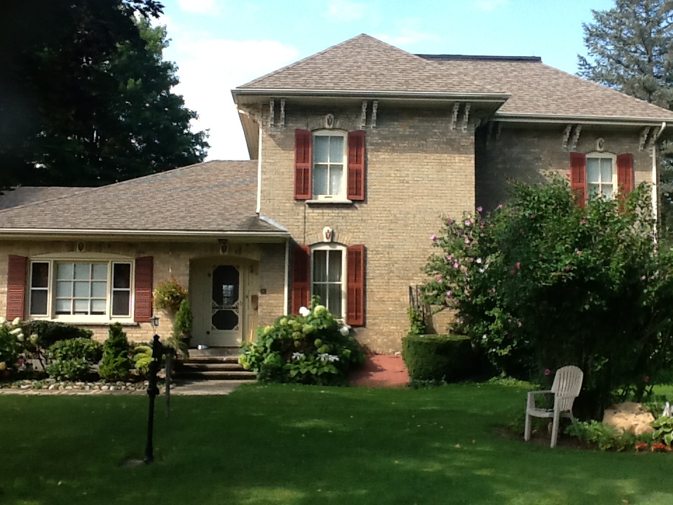 This building is a particularly fine example of 1880 Italianate architecture constructed of yellow stretcher bond brick. The home was built in 1882 for James Imrie, a Scotsman from Haddington County, Scotland, on land he purchased from Charles Potter. The structure illustrates the desire of the original owners to present his achievements in the new world. His heritage is supported by his use of the Scotch Thistle in the keystones and the fact that he called his home Haddon Hail. In the 1932, the house and farm were sold to James L. McCabe in which during that time minor renovations were made. In 1960 the house was sold to George Gilvesy in trust for Andy Gilvesy. In 1968 the farm was formally passed on to Andren Investments.
The exterior features that are worthy of mention are the turned pendant brackets under the overhang of the roof, the moulded thistle keystones contained in radiating voussoirs over all the windows and doors. The windows have two sashes with two panes of glass in each. Each window has a moulded lug still. Wooden louvered shutters enhance the windows. The front entrance has a double door each containing a round headed window with moulding. Rectangular panels with similar moulding trim are found in the lower portion of the door. Above the door is an arched transom light. The curved architecture with a thistle keystone rests on the fluted pilasters forming the door surround.
The interior of the home features wide baseboards and door frames. Especially interesting is the octagonal newel post on the stairway with a pine railing. On the open side of the staircase is a French curve appliqué. A large plaster ceiling medallion in a fruit design is a distinctive part of the living room.
This home represents a fine example of 1880’s architecture with significant exterior features which include the turned pendants, the thistle keystones and the front entrance. The interior features include the ceiling medallion, the staircase with the octagonal newel post and French curve appliqué and the woodwork.
Gilvesy House
Location:
Lot 26, Concession 12, 144760 Potters Road (former South Norwich Township)
Designation By-law 16-1990
Description of Historic Place:
This building is a particularly fine example of the many lofty-ceilinged, Italianate white brick structures built in the Village of Norwich in the 1880’s.
Exterior Features worthy of mention are the oval moulded panels, paired brackets and decorate brickwork under the eaves. The centre doorway is enhanced by frosted sidelights and frosted panels in the door. The front porch, a recent addition is a replica of the original. The double chimneys are also noteworthy.
Several interior features are distinctive. There is an octagonal-faced newel post on the centre staircase. The detailed cherry panelling of the parlour wainscoting matches the panelled doors throughout the house.
The cherry fire-cast iron grill bordered by ceramic tiles in a Scottish thistle design.
Location:
LOT 745, PLAN 745 9 COOK ST., NORWICH (VILLAGE OF NORWICH)
HISTORICAL DESIGNATION BY-LAW 39-1986
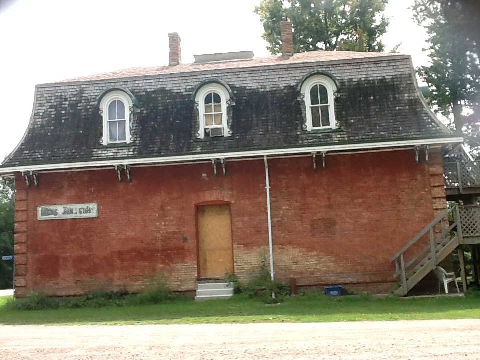 The present Hawtrey store was built in the 1870’s by George Southwick when the village of Hawtrey contained two hotels, two stores, two black smith shops, and a large shingle and planning mill. The store was purchased from Sam Innis by the late John Beck in 1920 and was initially leased to the United Farmers of Ontario. Soon thereafter, John Beck married and he and his wife operated the store continually until shortly before his death in 1974.
This French Renaissance commercial building is architecturally exceptional for a small village. Its decorative Mansard roof, providing extra head room for the upper storey, was originally adorned with a roof walk with turned balusters, and two distinctive double chimneys. The hooded dormers are relatively simple except for the scroll designs on the sides. The elaborate brackets under the eaves have turned pendants.
The body of the building is finished at the corners with brick groining. The original façade had large four-paned windows surrounding a recessed double door. These windows were topped with a scalloped edge. The front has been covered over but the original windows and door are still inside. The original counters and shelving are found inside the store.
Location:
Part Lot 1, Concession 11, 82227 Baseline Road (former South Norwich Township)
Designation By-law 12-1984
Description of Historic Place:
This structure is of considerable historical importance. It is the birth-place of Harold Adams Innis (1894-1952). Innis is internationally recognized as one of Canada’s foremost social scientists.
From 1920 until his death in 1952, he taught in the Department of Political Economy at the University of Toronto, where he produced a number of classic works in Canadian economic history, including the History of the CPR (1923), The Fur Trade in Canada (1930), Settlement and the Mining Frontier (1936), The Cod Fisheries (1940), and Essays in Canadian Economic History (1964). After 1940, Innis shifted his concerns to the rapidly expanding field of communications theory and produced such innovative and highly acclaimed works as Political Economy in the Modern State (1946), Empire and Communications (1950), The Bias of Communication, and Changing Concepts of Time (1952).
Innis was also the first Canadian born Chairman of the Department of Political Economy and served as the dean of Arts and Science at the University of Toronto. Moreover, he was instrumental in the development of post-graduate studies in Canada, not only at the University of Toronto but also at other universities across Canada. More than any other Canadian intellectual of his generation, Innis helped to foster a sense of national identity distinct from that of the United States.
The structure is a 1 1/2 storey Ontario Farm House of red brick. The front façade features a stained glass window in a half-moon shape.
Location
N. PT LOT 4, CONCESSION 9 (SOUTH NORWICH)
HISTORICAL DESIGNATION BY-LAW 57-1988
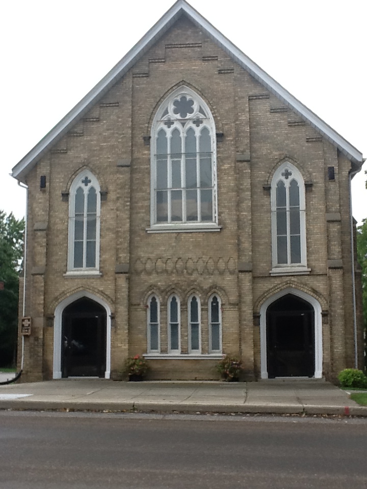 Knox Presbyterian Church is located at 67 Main Street West, on the south side of Main Street between Clyde and John Streets, in the Village of Norwich, in the Township of Norwich. The two-storey white-clay brick church was constructed in 1879.
The property was designated, in 1989, by the Township of Norwich, for its architectural and historical value or interest, under Part IV of the Ontario Heritage Act (By-law 67-89) and then updated in 1992 (By-law 27-92).
Heritage Value:
The Knox Presbyterian Church was erected in 1879, about 30 years after the Norwich congregation was established. Its continuous use as a church since that time attests to the strength of the congregation. The Knox Presbyterian Church is a fine example of the Gothic Revival style of architecture, featuring a steeply pitched gable roof and lancet arched windows and entrances. Of note is the elaborate central window on the façade, formed by a pair of double trefoil lancet windows surmounted by a coloured glass surround, and the double trefoil lancet windows on the façade and side elevations, capped with a cruciform window of coloured glass and a brick surround. Also of note are the double main entrances, featuring elaborate wood and brick surrounds that incorporate a roped design labelled with relief carvings of wooden
leaf motifs.
Source: Township of Norwich By-laws 67-89 and 27-92.
Location:
Lot 581, Plan 955, 67 Main Street West, Norwich (Village of Norwich)
Designation By-law 26-1992
Description of Historic Place:
This building of historical and architectural significance was built in a gracious gothic style with exceptional detail in the design of the brickwork. The bargeboard, widow’s walk and brackets nicely complete the appearance.
This storey and a half castle-like yellow brick house, built by Gilbert Moore between 1876 and 1880 from plans thought to have been obtained in England, was known as “Avonmore.”
Gilbert Moore contributed much to the development of Norwich—he erected the Moore block on Main street, the only three-storey block remaining in Norwich. Gilbert Moore was the first reeve of the Village of Norwich in 1876, president of the Agricultural Society, postmaster, president of the Port Dover-Lake Huron Railroad Co., and world traveler.
The brickwork of the main façade is unusual in that it is laid in Flemish bond with the bricks placed alternately lengthwise and crosswise in every row. Herringbone brickwork is used in Gothic arches over the windows which are completed with pointed stone keystones. To the right of the main door the windows are set into a projection. The other three facades are done in common bond brickwork and lack the front’s special window treatment.
The open porch with its Baronial castle top feature cement caps and horizontals with rounded arches. This was added several years after the house was built, probably by Henry Moore – Gilbert’s son.
A widow’s walk of turned spindles at one time crowned the truncated slate hip roof. The gables are decorated with fret-work bargeboards. Pairs of turned brackets adorn the bay of the east façade. The left of the front bedroom window is not the original window. The interior of the house is elegantly trimmed with massive baseboards, fine woodwork, window panels, graciously turned newel posts, and a feathered plaster medallion decorating the hall ceiling. A coloured glass window at the turn of the stairway is noteworthy.
Location:
Part Lot 720, Plan 955, 8 Main Street East, Norwich (Village of Norwich)
Designation By-law 68-1990
Description of Historic Place:
The Museum School is located at 656 Main Street North, on the east side of Main Street North, south of Highway 59, in the Village of Burgessville, Township of Norwich. The two-storey red-brick school was constructed in 1905.
The property was designated, by the Township of Norwich, in 1987, for its architectural or historic value or interest, under Part IV of the Ontario Heritage Act (By-law 32-87).
Heritage Value:
The Museum School opened as S.S. #3 North Norwich in 1905 and served as the community elementary school until its closure in 1961. The Museum School, which was converted to a museum in 1976, is
significant as it is representative of rural school heritage in Norwich Township. It now functions as a museum and interpretive centre that allows students of today to experience school life of the past. In addition to the school building, the Museum School also features a belfry to the southeast of the museum building, which commemorates its earlier use as a school.
The Museum School is constructed of red-brick in the Baronial style of architecture. Typical of this style, the School features a symmetrical plan, a projecting tiered buttress in front of a central square bell tower, and a steeply sloped roof. Also of note are the second-storey arched windows and the contrasting brickwork above the second-storey windows.
Location:
Lot 27, Plan 239, 656 Main Street North, Burgessville (former North Norwich Township)
Designation By-law 32-1987
Description of Historic Place:
The Quaker Meeting House (Norwich Museum) is located at 89 Stover Street North, on the east side of Stover Street North, in the Village of Norwich, now the Township of Norwich. The two-storey white-brick
Quaker meeting house was constructed in 1889. The meeting house is part of a larger complex of historically significant buildings that makes up the Norwich and District Museum.
The property was designated, by the Township of Norwich, in 1989, for its architectural or historic value or interest, under Part IV of the Ontario Heritage Act, By-law 68-89.
Heritage Value:
The Quaker Meeting House was originally erected, in 1889, by the Orthodox Friends, as a place of worship. There was a large Quaker community within the Norwich area. Quakers were among the first
settlers of the Norwich area, when Quaker Peter Lossing and his brother-in-law Peter DeLong purchased 15,000 acres of land and moved their families and friends there from Dutchess County, New York, in 1810. This building was the seventh Quaker meeting house constructed in the Township of Norwich, but is the only one which remains in a largely unaltered form.
The Norwich and District Museum opened in 1970, and operates out of the Meeting House. It commemorates the Quaker history and the agricultural and social history of Norwich. In addition to the Meeting House, the Norwich and District Museum also features Peter Lossing's 1812 saltbox house, a turn-of-the-century Quaker schoolhouse, relocated to the property.
The Quakers placed importance on plainness of speech, behaviour and apparel. The architecture and materials of the Quaker Meeting House reflect the simplicity of the Quaker way of life. Constructed of locally produced white clay brick with a plain slate roof, the Meeting House features a broad gable over the main entrance and a two-panelled door, which and south elevations which frame four plain, double-hung windows.
Location:
Part Lot 8, Concession 4, 89 Stover Street North, Norwich (former North Norwich Township)
Designation By-law 68-1989
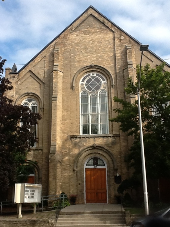 The Norwich United Church and Manse is located at 80 Main Street West, on the northwest corner of Main Street West and Clyde Street, in the Village of Norwich, Township of Norwich. The two-storey white-brick manse was constructed in 1875. The two-storey brick church was constructed in 1885.
The property was designated, by the Township of Norwich, in 1985, for its architectural and historical value or interest, under Part IV of the Ontario Heritage Act (By-law 27-85).
Heritage Value:
The Norwich United Church Manse was constructed in 1875 as a parsonage for Methodist and later United Church ministers of the Norwich congregation. The Manse, which is still used as a home for ministers, has played a significant role as the link between the minister, the congregation and the community for over 125 years. The Norwich United Church is representative of the importance of both the Methodist and United churches in the Norwich area. It has been a place of continuous worship for over 120 years. Originally created as the Norwich Methodist Church, in 1885, it is situated on the site of two previous churches.
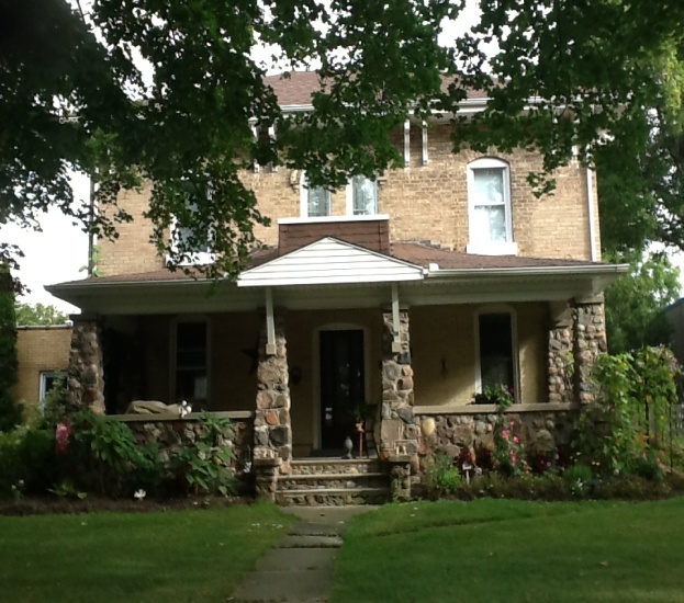 The original frame church, of 1824, was moved off site in 1861. The 1862 brick church was replaced by the building that stands today. The Methodist Church in Canada merged with other Protestant denominations to form the United Church of Canada in 1925.
The Norwich United Church Manse is a blocky, Italianate residence that was the prototype for more than forty similar homes in the Norwich area. Constructed of white-brick, the Manse, features many outstanding exterior and interior elements. Characteristic of the Italianate style, it exhibits symmetry and decorative elements, such as the paired brackets under the roof eaves and the twin round-headed windows and doors of the second-storey. The interior of the Manse is equally impressive and boasts handcrafted door and window trim,
wide baseboards, an archway in the living room, panelling below the windows and parlour wainscoting. Also of note is the half-spiral staircase with oak banister, which stands as a focal point of the centre hall.
The Norwich United Church, like the Manse, was designed in the Italianate style
and is an architecturally striking building. Designed by architect William Mellish of Brantford, it was constructed by William Merrill, a local trustee of the Methodist church. The church is constructed of 200,000 bricks from the local Irwin brickyard. Typical of the Italianate style, the church features a broad gable with three recessed doors below triple round-headed windows. The façade and elevations of the church are supported by slender buttresses which grow out of the bases of the moulded window surrounds. Also of note are the front doors topped with original stained glass windows. Interior features of the sanctuary that are worthy of mention include the apse, the nineteenth century pipe organ, the cast-iron-ended numbered pews and the wide pine floors and baseboards.
Location:
Lot 169, Plan 745, 80 Main Street West, Norwich (Village of Norwich)
Designation By-law
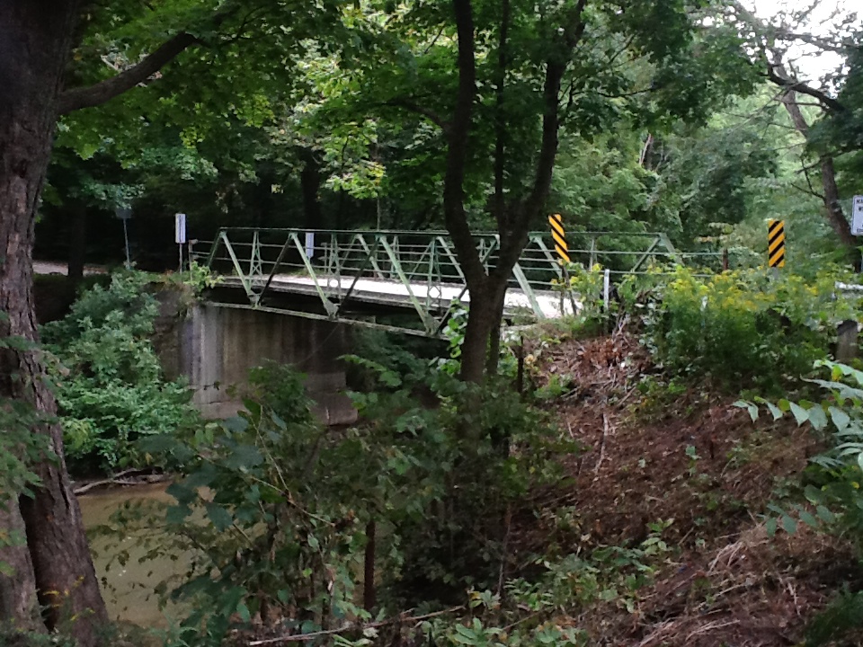 The Otter Creek Bridge, spans the Big Otter Creek and is located on Middletown Line between Cornell and New Roads, in the Township of Norwich. The steel pony truss bridge was constructed in circa 1900. The property was designated, by the Township of Norwich, in 1987, for its historical or architectural value or interest, under Part IV of the Ontario Heritage Act (By-law 33-87). The Otter Creek Bridge has also been listed on the Ontario Heritage Bridge list, a list of provincially significant bridges
maintained by the Ontario Ministry of Culture. This bridge, which has been placed on the Heritage Bridge List of Ontario, is one of the few remaining of pony truss steel bridge construction and is among the first of its kind built in Ontario. This bridge is a landmark in an especially beautiful natural rural landscape, which should be preserved, and remain accessible.
Heritage Value:
Built by the Hamilton Bridge Company in circa 1900, the Otter Creek Bridge is one of a few remaining steel, pony truss bridges in Ontario. Steel bridges proliferated rapidly in Ontario after 1900, and pony trusses, which were easy to erect, comparatively inexpensive and readily available, peppered the landscape. The pony truss design is low, lying alongside the bridge deck which allows light truss units to cross relatively large spans. The single lane capacity of pony trusses, however, resulted in many municipalities upgrading to two lane bridges. The Otter Creek Bridge is of the Warren Truss form which uses diagonals in the shape of “W's” as its bracing and load bearing system. It also features bolted joints and a wooden deck. The Otter Creek Bridge is a significant landmark in Oxford County. It is located on what was once a well- travelled rural road in the former South Norwich.
The Otter Creek Bridge's location on a forested winding road, contributes to the scenic rural landscape. It is a favorite location of local fishermen, naturalists and artists.
Source: Discovering Heritage Bridges on Ontario's Roads, David J. Cumming, 1951.
Location:
Lot 14, Concession 10, Middletown Line (former South Norwich Township)
Designation By-law 33-1987
Description of Historic Place:
The property was designated, by the Township of Norwich, in 1982, for its historical or architectural value or interest, under Part IV of the Ontario Heritage Act (By-law 5-82).
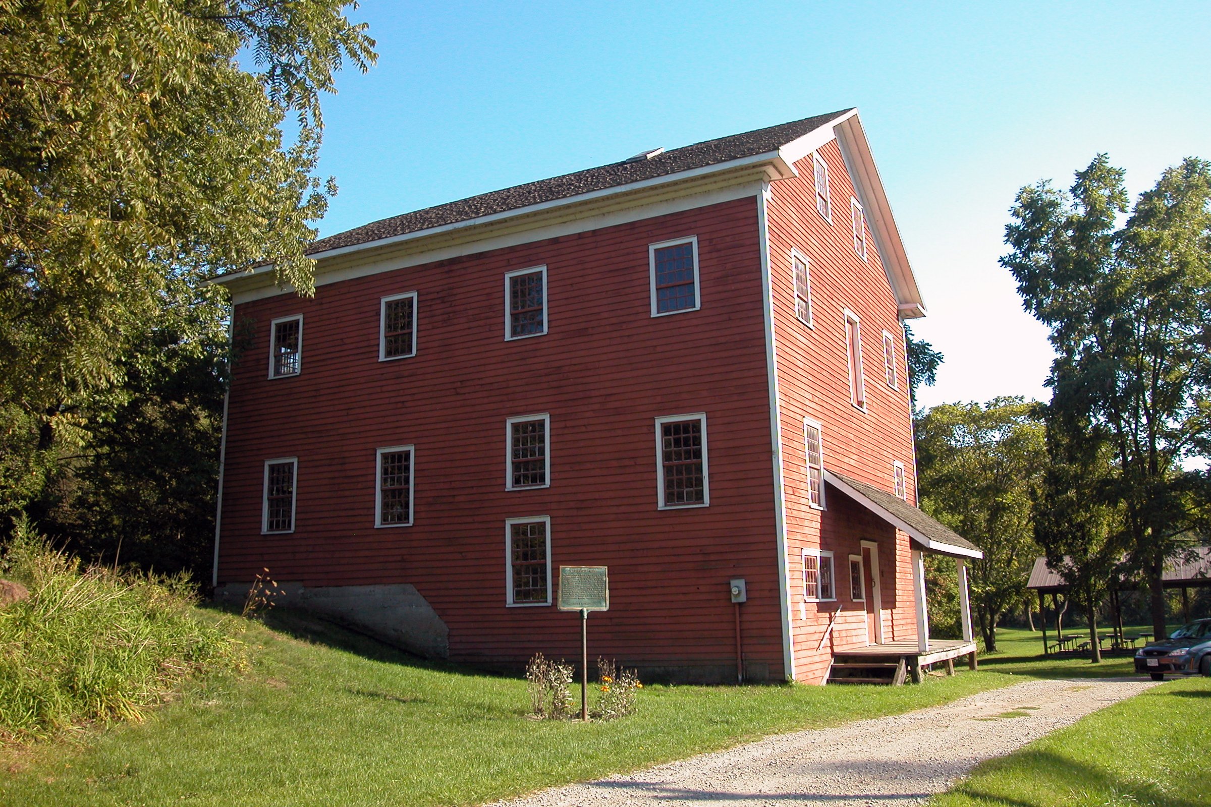
The Otterville Mill overlooks the Otter River and is sited in a picturesque
meadow, within the center of the village and surrounded by a forest.
Heritage Value:
The Otterville Mill is one of the oldest continuously operated wheel-powered mills in Ontario. Built in 1845, by Edward Bullock, and operated by Matthew Maddison, it was used as a grist and flour mill, with
anannual capacity of 20,000 bushels. The first mill on the site was built, in 1807, by John Earle and Paul Avery. The wooden water wheel mill, operated by a water turbine, greatly contributed to the early commerce of Otterville in the 19th century. It was also the hub of the farming community, as many farmers visited it weekly to have their cattle feed ground.
In later years, the mill was purchased by Solomon Lossing, son of Peter Lossing, who is credited with founding one of the most successful Quaker settlements in Canada. Solomon, who took over as a spokesman for the Quakers in Norwich after his father's death, in 1833, bought the property in 1880. The
Lossing family had the ownership of the mill for 60 years, during which it became known as the Treffry Mill.
The Otterville Mill ceased commercial use in 1981, but continues to be operated by the South Norwich Historical Society, under lease from the township. The property is now known as Mill Park and is the site of an annual barbecue.
The Otterville Mill is an exemplary three-storey frame mill of simple post and beam construction with a fieldstone foundation. The ground floor posts are chamfered, for decoration, and the purlins measure eight inches by forty feet. The impressive construction and materials of the mill are accented by the 20 and 24 pane windows. Also of note are the leaves with wide overhangs and returning cornices.
Location:
Lot 145 & 146, Plan 388, 243 Main Street West, Otterville (former South Norwich Township)
Designation By-law 5-1982
Description of Historic Place:
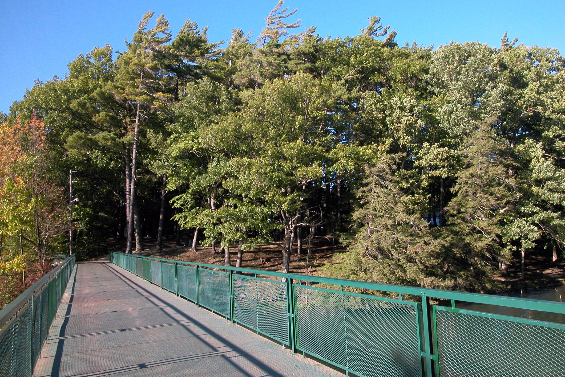
Otterville Park is on the north side of the Otter River and accessed from
North Street over a foot bridge, in the Village of Otterville, Township of
Norwich. The 10 acres of parkland were established in 1891 and
features a pavilion, constructed in 1924, and a cut fieldstone wall, on the south bank of the river.
The property was designated, by the Township of Norwich, in 1990, for its historic and architectural value or interest, under Part IV of the Ontario Heritage Act (By-law 17-90). The park is worthy of designation for its environmental significance, with its 100 foot trees which overlook the river, the “raison d’etre’ of the village. The stonework is a fine example of local craftsmanship. The pavilion, now used mainly as shelter for picnics and barbecues, is a symbol of the days when it was the centre of community entertainment, school fair exhibits, band concerts, picnics and dances.
Heritage Value:
Otterville Park is the main recreational area of Otterville. It is a symbol of the days when parks were the centre of the community. Established in 1891 by the Otterville Park Company, which sold over one thousand, $1.00 shares, to create the park. The money allowed the Otterville Park Company to clear one acre, on the north bank of the Otter River, at a location that had previously been a favourite of picnickers. A footbridge over the river and approximately 10 acres of land were added to the park,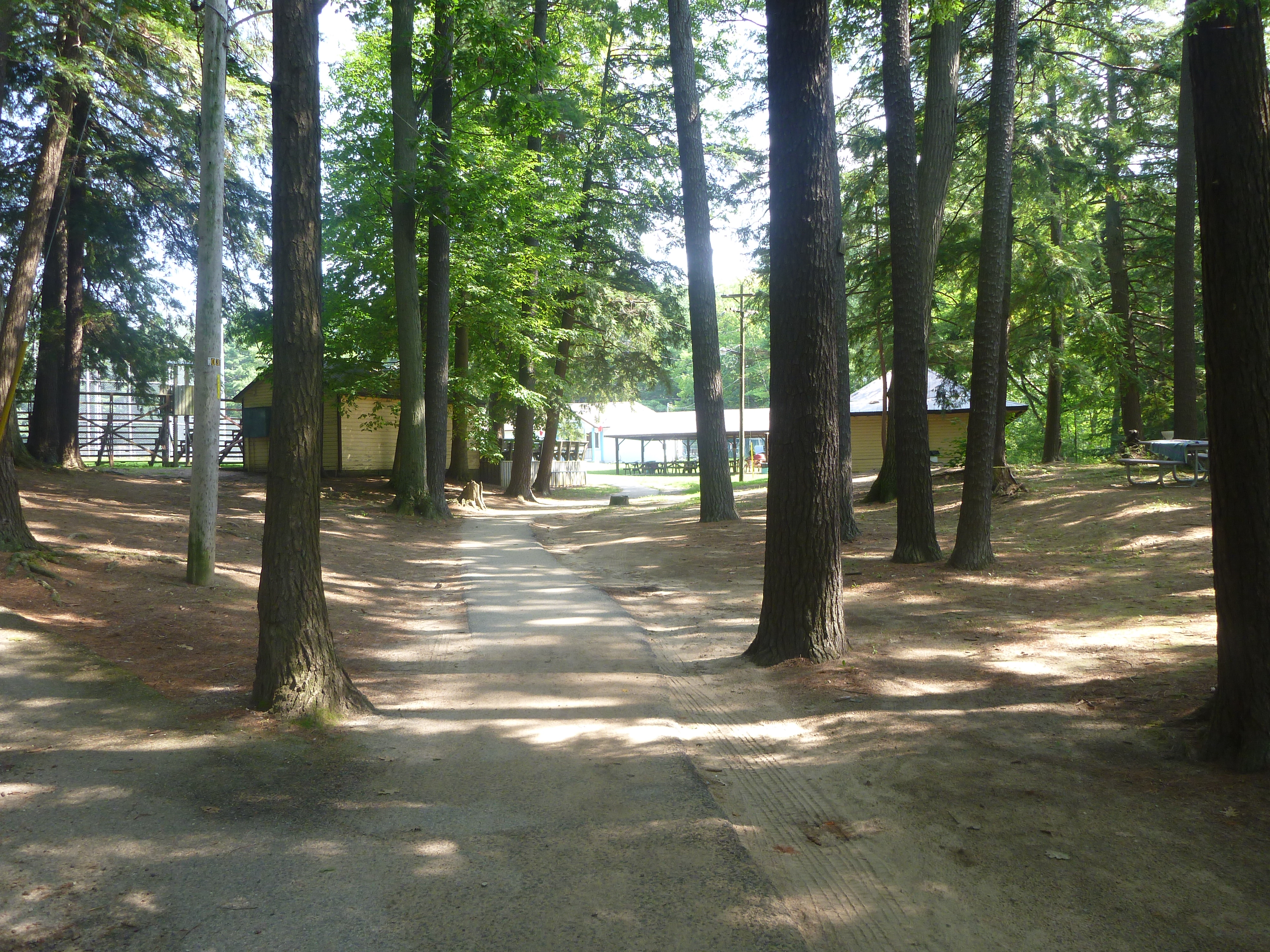
by 1920. In 1924, a local building at the fair ground, Crystal Palace, was dismantled and the materials were used to build a Pavilion, in the park. Providing shelter for picnickers and acting as a dance floor and bandstand on various occasions, the Pavilion on served as the centrepiece of the park. It is of post and beam construction with folding sides and simple scalloped ornamental braces on the posts.
The Otterville Park entrance is marked by a fine cut fieldstone wall, with a pillared gateway, on the south bank of the river. Also incorporated into the design is a bronze plaque honouring the area's World War I
veterans. The stonework was completed by local stonemason, Alfred E. Moore. Another significant feature, added in 1907, is an 1807 cannon, donated by the Federal Government. The cannon commemorates the centennial of the area's settlement. The park now features a swimming pool, ball diamond, horseshoe pitch, tennis and basketball courts, and children's playground. The park has
minimal landscaping, but features many tall pines.
Location:
Lot 11, Concession 8, 2 North Street East, Otterville (former South Norwich Township)
Designation By-law 17-1990
Description of Historic Place:
The Quaker Street Burying Ground is located at Lot 8 on Concession 3, on the north side of Quaker Street, west of the intersection of Quaker Street and County Road 59, in the Township of Norwich. The small 19th century cemetery was established in 1813.
The property was designated, by the Township of Norwich, in 2006, for its cultural heritage value or interest, under Part IV of the Ontario Heritage Act, By-law 64-2006.
Heritage Value:
The Quaker Street Burying Ground is the site of the first cemetery and Quaker meeting house, in Norwich Township. The land was set aside as a site for a meeting house and burial ground, in 1813, shortly after settlers led by Peter Lossing and Peter De Long, many of whom were Quakers, arrived in what is ow Norwich Township, from Duchess County, in New York. The 1810 Quaker Migration into the Township led to the development of one of the most populous Quaker settlements in Upper Canada. The first documented burial occurred at the Quaker Street Burying Ground in 1817, the same year that the meeting house, now demolished, was erected.
The Quaker Street Burying Ground contains the graves of many of Norwich Township's earliest settlers and their ancestors. Of note are Peter Lossing; his son Solomon Lossing, who was a major figure in the
local rebellion of 1837and later an early warden of Oxford County; Henry and Anne Wasley, who were great-grandparents of United States President Herbert Hoover; and Daniel Bedford, who was a hanged rebel of the 1837 rebellion. Many of the early settlers are commemorated by a Norwich Pioneer Society plaque ,located in the cemetery, that lists family name and place of origin of the pioneer settlers of Norwich Township.
Many of the grave markers are plain marble tablets that are consistent with the Quaker concern for simplicity. The Quaker custom of numbering days and months is evident on many of the markers. Quakers did not believe in using the names of the months and preferred instead to use the number to which each month was associated. January would be “First Month”; February is “Second Month” and so on.
Location:
PART OF SOUTH EAST PART OF WEST HALF OF LOT 8, CONCESSION 3 8 QUAKER ST., NORWICH (NORTH NORWICH)
HISTORICAL DESIGNATION BY-LAW 64-2006
Description of Historic Place:
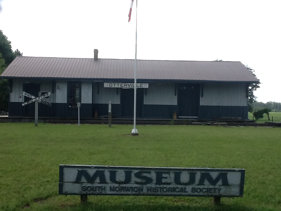
The Otterville Railway Station is located at 225422 Main Stre
et West, on the south side of Main Street West, east of Middletown Line, at the west end of the Village of Otterville, in the Township of Norwich. The single-storey wood railway station was constructed in circa 1875.
The property was designated, in 1990, by the Township of Norwich, for its historic and architectural value or interest, under Part IV of the Ontario Heritage Act (By-law 18-90).
Heritage Value:
The Otterville Railway Station was constructed in circa 1875 as the Otterville station of the Port Dover Lake Huron railway line, which linked Port Dover with Woodstock. The construction of this line in 1875, three years after the Port Dover Lake Huron Railway Charter was granted in 1872, marked the completion
of a hard fought battle for railroad transportation for the area. The Port Dover Lake Huron Railway line served as an important social and economic linkage for the communities it serviced, providing access to the world of commerce, education, entertainment and communication. One could send a letter in the morning and have a reply by night, a true accomplishment for rural townships such as Norwich. In 1881, the Grand Trunk railway assumed control over the line, followed by the Canadian National Railway, in 1923. The last passenger train left Port Dover for Woodstock in 1935, ending a much used service. The station was relocated in 1989 to its current site on Main Street West from its original site on North Street.
The Otterville Railway Station is a rare example of a village railroad station, relatively few of which remain in Ontario. Built in circa 1875, the station is of post and beam construction, with board-and-batten siding. Characteristic of railway station architecture, it features a side gable roof with wide overhanging
eaves, supported by prominent eave brackets. The station agent's office, distinguished by a nine foot bay on the façade, is flanked by a waiting room, at the east end of the station, and a freight shed, on the west. Also of note are the eared pediment architraves located above the waiting room doors and windows, and the freight doors, which feature transom lights and an apron of horizontal tongue and groove boards.
Location:
Lot 14, Concession 9, 225422 Main Street West, Otterville (former South Norwich Township)
Designation By-law 19-1990
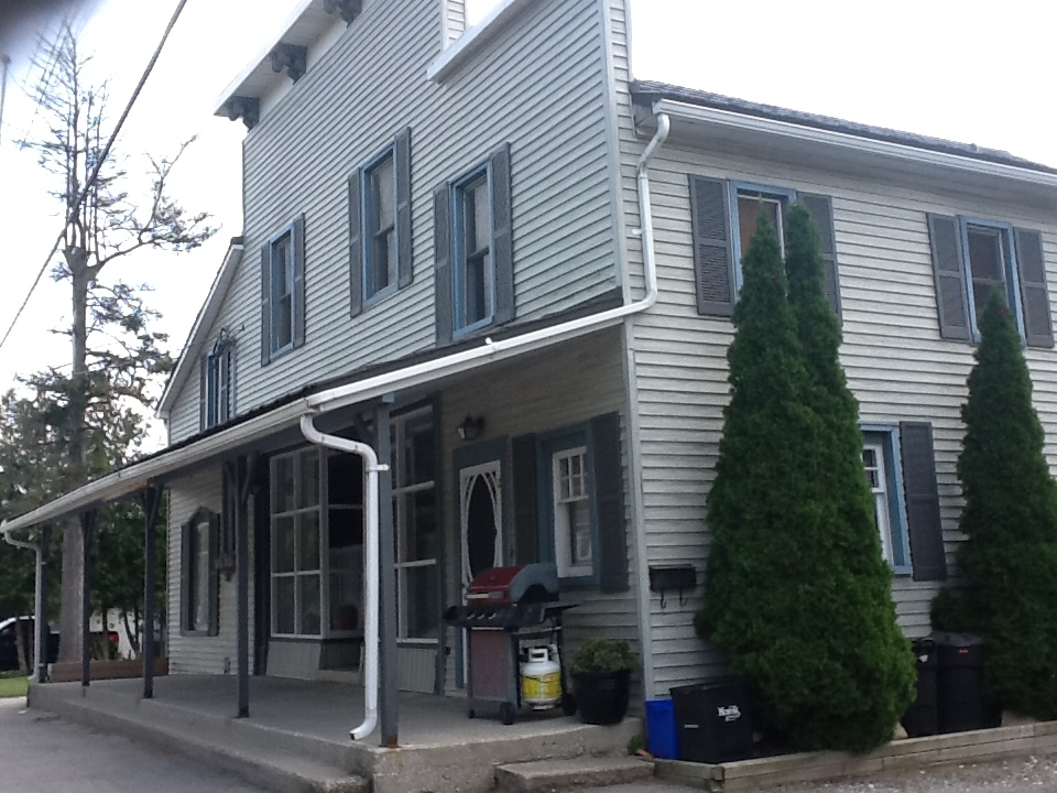 This early frame store has long been the centre of the village of Springford. Built in 1850 of post and beam construction it features a boom town front, originally of lapsed wooden siding topped with a wide overhanging cap decorated with four pairs of spiral brackets.
The west wing, also with boom town front, housed the post office which opened in this building from 1852-1977, except for four years.
The first storey façade has two large windows of multi-paned sash, recessed front door and simple porch held by square posts. This porch is a replacement of a similar one which was supported by posts decorated with aprons and simple upper trim.
A large multi-paned window was originally in the post office section. The east wing of the front façade contains a large window with multi-coloured glass in the upper sash.
Location:
NW Part Lot 21, Concession 9, Lot 2 and Part Lot 3, Plan 32, 407 Main Street, Springford (former South Norwich Township)
Designation By-law 56-1988
Description of Historic Place:
This carpenter Gothic style, 1 ½ storey farmhouse was built sometime between 1872 and 1875 by George Start, who had moved from DurhamCounty to purchase this property from the Church of England in 1870. The Gothic projection on the front façade is used to give distinction to an otherwise common style of architecture.
It retains one of its original four-paned windows, the gingerbread in its gable, its transomed and side lighted front door and its wooden shutters.
The original front porch was moved in 1917 to a 1 ½ storey kitchen addition. A round-topped, second storey window above the front door was squared at that time.
Interior features include pine floors with trim, wide pine window frames panelled to the floor and a plaster ceiling medallion in the front hall.
This home is one of the few in the country that has been continuously inhabited by the same family. Many generations have lived on this century dairy farm.
Location:
Part Lot 16, Concession 5, 465141 Curries Road (former East Oxford Township)
Designation By-law 41-1986
Description of Historic Place:
The Sutton-Clark House is a red brick house built in the period 1850 to 1860. The house design, which recalls the Greek Revived form, contains the Quaker influence in its simple dignity. The collaborative foundation finish at the front of the house is a feature unique to this area. The back portion of the house, approximately 9 metres, was built about 1850 with a brick oven and fireplace in the middle of the structure. The front of the house, 12 metres by 9 metres, contains two front windows, each containing 20 panes. This front portion was built about 10 years later. It is believed that the windows came from New York State. There are original blue glass side lights and transom over the front doorway. The house originally had full length closing shutters on door and windows. As unusual feature is the three wooden window grills under the eaves that allow light into the upstairs bedrooms. The house also has a slate roof and chimneys at both ends of the roof peak.
Location:
Part Lot 13, Concession 4 (former North Norwich Township)
Designation By-law 13-1984
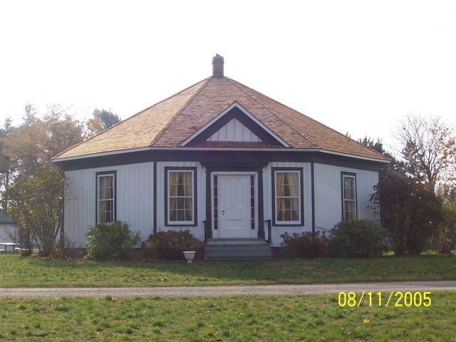
Woodlawn Place, located at 225422 Main Street West, is situated on the south side of Main Street West at the west end of the Village of Otterville,in the Township of Norwich. The property consists of a single-storey, octagonal, board and batten house that was constructed in 1861. The property was designated in 1977, by the Township of Norwich, for its heritage value, under Part IV of the Ontario Heritage Act (By-law 84-77).
Heritage Value:
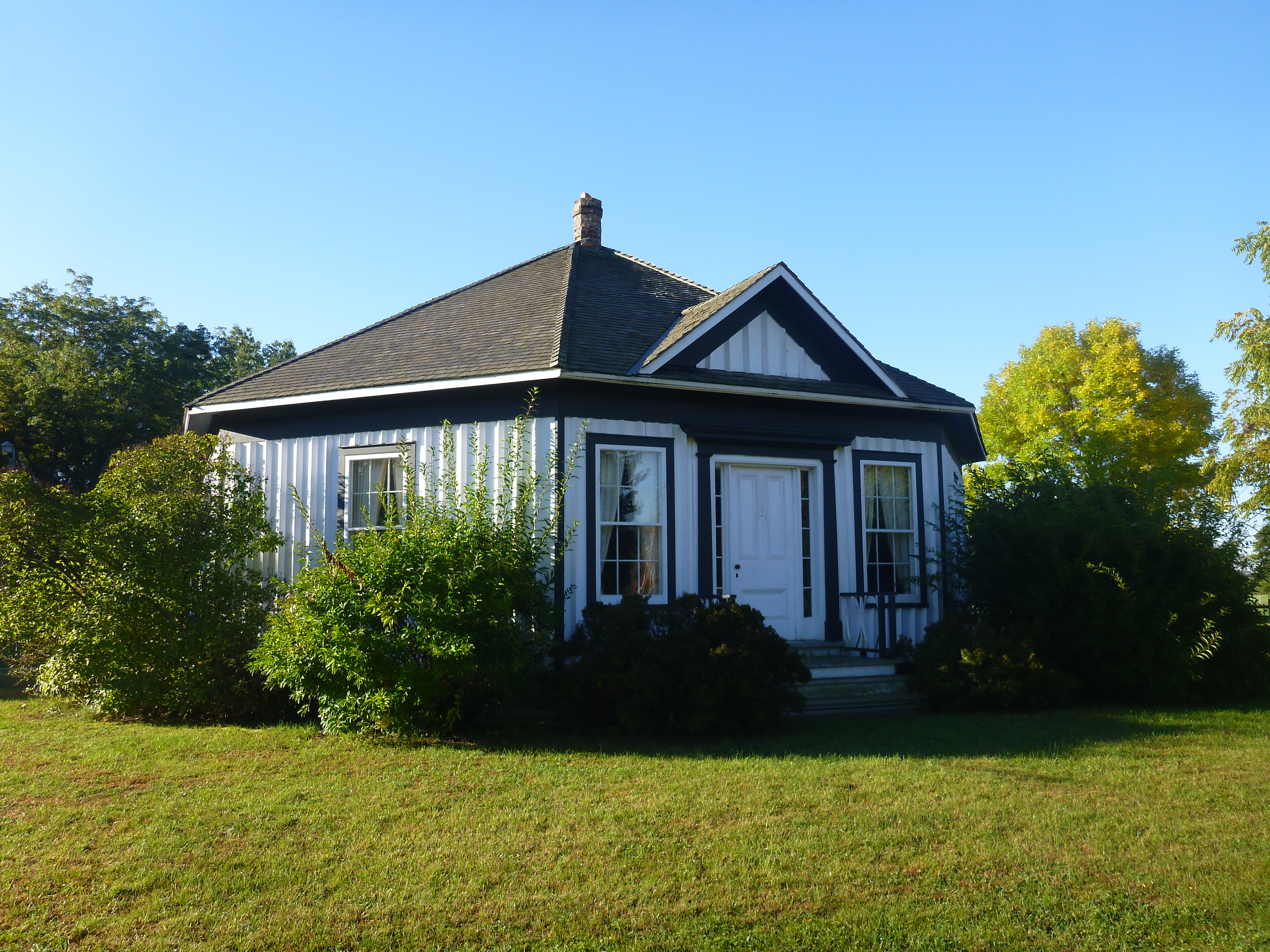
Woodlawn Place is associated with Thomas Wright, a once local, prominent inventor who designed and lived in the building, in the mid-19th century. Nature influenced Wright's design and the home's shape is reflective of that in its octagonal plan. Wright was also influenced by Dr. Orson Fowler, whose 1853 book, “The Octagonal House –A Home For All”, encouraged the practicality of octagonal dwellings. Fowler argues that these homes were easier to heat and made greater use of the sun's rays.
Woodlawn Place is a fine example of the Regency Cottage style of architecture although, its octagonal shape makes it unusual. The building is of plank construction with board and batten siding. The overall plan consists of a 45-foot octagon with a 20 foot by 20-foot wing that is situated to form a trapezoidal umbr
age at the side of the house.
Typical of the Regency style, Woodlawn Place features a wide roof overhang and deep fascia boards. The front door is flanked with sidelights and Doric pilasters, complimented by a simulated entablature above. The wing is decorated with regency treillage.
Woodlawn Place was originally constructed at Lot 7, on Concession 8, in the former Township of South Norwich. As a means of preservation, it was relocated to Main Street West, where its historic association with Otterville could be celebrated. It is now located adjacent to several heritage resources, including, the former Grand Trunk Railway Station, the Pine Street Burial Ground and the Erbtown Cemetery.
Designation By-law 84-1977
